Environmental-Intelligence-Suite
IBM Environmental Intelligence Suite integration for Maximo Spatial Assets </h1>
IBM Environmental Intelligence Suite integrates with the IBM Maximo solutions suite to simplify GeoSpatial monitoring of client Maximo assets for additional insight. Release 1.0 empowers users to import Maximo Asset Locations in order to expand their exploration of weather and other geospatial data layers. In order to perform the import operation, you would require the URL of the Maximo instance, Maximo API credentials and Environmental Intelligence Suite user credentials issued to you at the time of provisioning.
Action: Ask your IBM representative to provide a IBM Environmental Intelligence Suite API_KEY for your user.
Generate JWT token to access IBM Environmental Intelligence Suite Service APIs
Substitute <API_KEY> in the following request and call it in a terminal window :
curl --request POST --url https://auth-b2b-twc.wsitrader.com/Auth/GetBearerForClient --header 'Content-Type: application/json' --header 'cache-control: no-cache' --data '{"apiKey":"<API_KEY>", "clientId":"ibm-agro-api"}'
Response:
{"access_token":"<JWT_TOKEN>","expires_in":"xxxxxx","token_type":"Bearer","scope":"xxxxxxx"}
Action:
Copy the value corresponding to <JWT_TOKEN> from the repsonse above to use in the Import API call below. This token would expire within the expiration window indicated by ‘expires_in’, following which you can repeat the JWT generation call above to get a refreshed token.
Import assets from Maximo
Trigger One-shot Import job
Substitute <JWT_TOKEN>, <ASSET_COLLECTION_NAME>, <MAXIMO_AUTH> and <MAXIMO_URL> in the following request and call it in a terminal window :
curl -X POST -H 'Authorization: Bearer <JWT_TOKEN>' --data '{"displayName": "<ASSET_COLLECTION_NAME>", "maxauth":"<MAXIMO_AUTH>", "serviceUrl": "http://<MAXIMO_URL>/maximo/oslc/", "limit": 200}' 'https://foundation.agtech.ibm.com/v2/assetimport/source?mode=e2e' -i
Response:
{
  "code": "202",
  "message": "Number of assets imported [200]",
  "timestamp": "2020-Dec-10 12:50:46",
  "id": "<UNIQUE_ID>",
  "targetResponse": "Block added"


}
Status of the Import job
Substitute <UNIQUE_ID> from the response above and your <JWT_TOKEN> in the following request and call it in a terminal window:
curl -X GET "https://foundation.agtech.ibm.com/v2/assetimport/status/<UNIQUE_ID>" -H "accept: application/json" -H "Authorization: Bearer <JWT_TOKEN>"
Response:
{
  "status": "LOADED",
  "message": "LOADED successfully",
  "last_modified": "2020-Dec-10 12:50:46"
}
Verify assets have been loaded into IBM Environmental Intelligence Suite
1. Login to IBM Environmental Intelligence Suite with your username and password by launching http://weatheroperationscenter.ibm.com - and navigate to Dashboard Visualization -> Interactive Map:

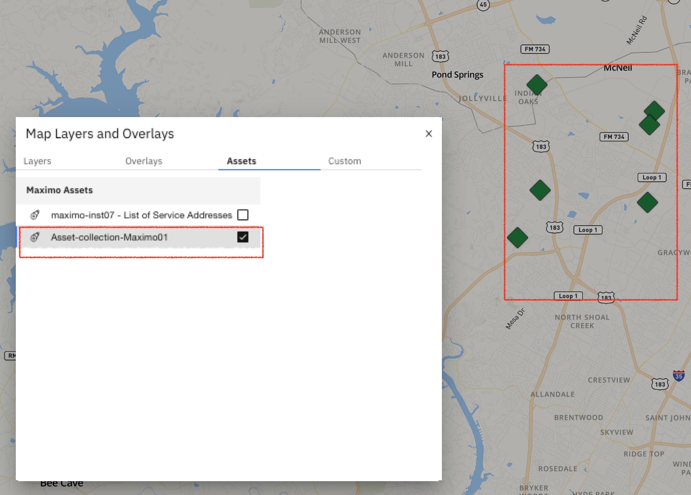
- Click on Map Layers and Overlays:

- Select your asset collection (named
in Import step above):
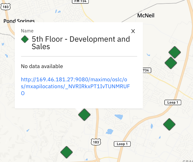
- Select a Maximo asset on the interactive map to view details:
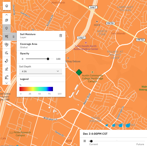
- Turn on out-of-the-box weather layers to assess relevant attributes impacting the asset:
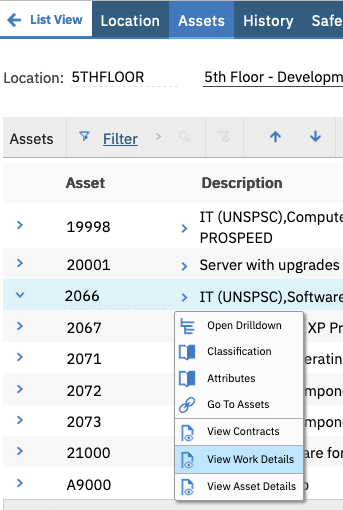
- If work order creation/modification is needed based on the assessment in step 5, click on the link within the popup display in order to go directly to the Location within Maximo or search for the Location by the name within your Maximo UI (copied over from step 4 above):

- View ‘Work Details’ and adjust as necessary: